Skip to content

Sat Update: The Front Range Forecast: Warm now, wet/snow Wed/Thur

In Brief:

Warm weather again, a mid-week storm on tap.

Saturday Update:

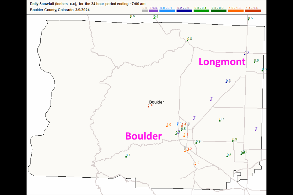
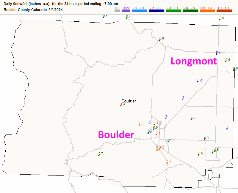
We received a bit of snow and very little rain from our week-end storm (Figure 1 update). Longmont saw about 1/2 inch of snow. Boulder picked up around an inch.

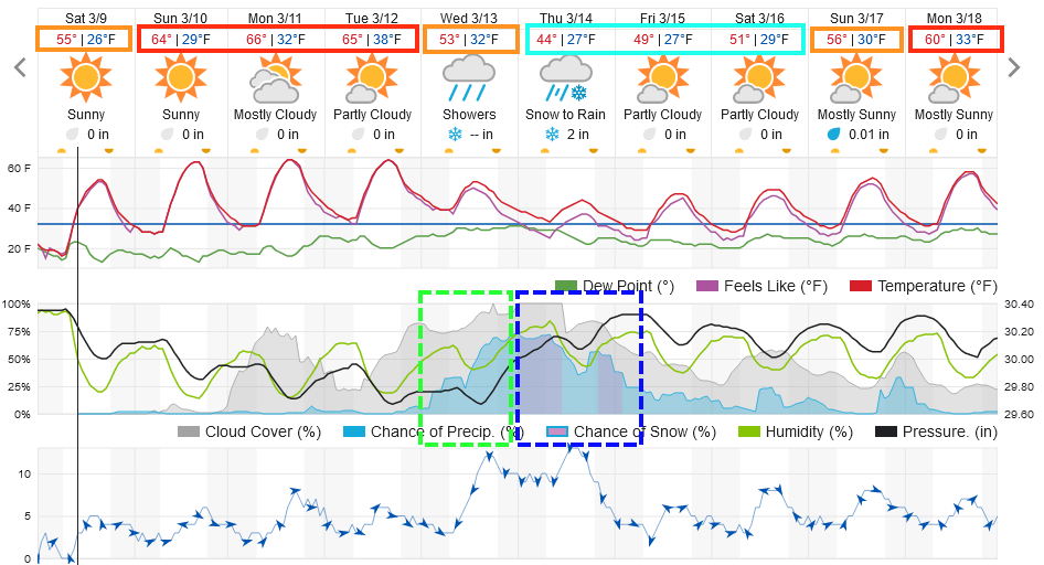
We rocket to the upper 60's for the first part of the week until the next storm system approaches (Figure 2 update).  We cool only to the lower 40's for highs with rain and a couple of inches of snow possible Thursday.  This is still fairly far out and temperatures are, again, marginal.

figure1u_03092024
Figure 1 update: the snowfall reports from CoCoRaHS for Boulder county.
figure2u_03092024
Figure 2 update: the 10 day graphical forecast for Longmont from weatherunderground.com

End Saturday update.

Forecast Discussion:

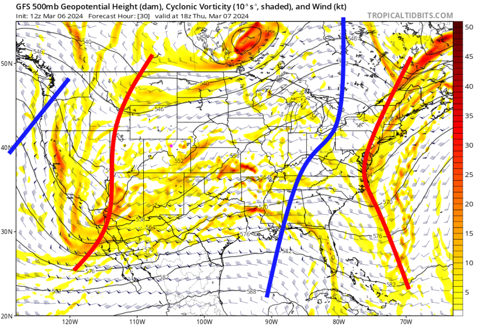
We reach temperatures near 60F on Wednesday before a cold front arrives late Wednesday night/Thursday morning (Figure 1). Rain chances slowly rise on Thursday becoming a good chance of showers by late afternoon changing to snow overnight (green and blue boxes).

This storm is powered by an approaching trough that will sweep by quickly (Figure 2). By Thursday night into Friday morning, there are snow chances across much of the state (Figure 3).

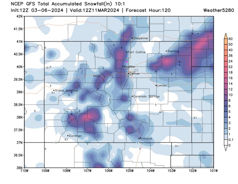
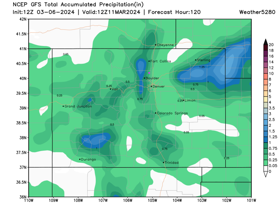
I'll return tomorrow for a snowfall roundup if things vary much from the forecast below, but the GFS shows a strong gradient of almost no snow along I-25 and eastward and healthy totals in thee nearby foothills (Figure 4).  Much of the precipitation that falls along the interstate will come down earlier as rain (Figure 5) with 0.25-0.75 inch of liquid in Longomont.

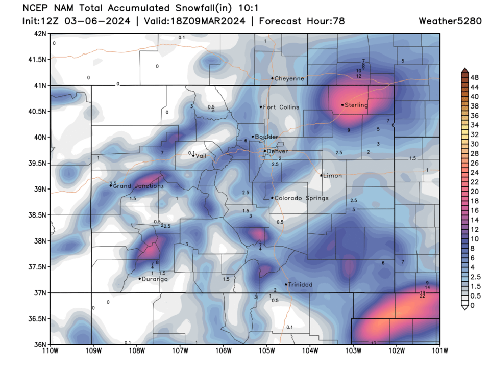
There IS some uncertainty in the forecast still. The NAM has much less snow around I-25 and into the Foothills. The big snow winners are out in the NE corner of the state and in the OK/TX panhandles. 

More later!

figure1_03062024
Figure 1: the 10-day graphical forecast for Longmont from weatherunderground.com
figure2_03062024
Figure 2: the 500mb upper air map Thursday noon from the GFS and tropicaltidbits.com


figure3_03062024
Figure 3: the Friday surface forecast from the NWS.
figure4_03062024
Figure 4: the 10:1 snowfall ratio forecast for the week-end storm from the GFS and weather5280.com
figure5_03062024
Figure 5: the precipitation forecast for the week-end storm from the GFS and weather5280.com
figure6_03062024
Figure 6: the 10:1 snowfall ratio forecast for the week-end storm from the NAM and weather5280.com

The Longer Range Forecast:

We pop back to the 50's then 60's by the weekend and into next week and remain dry until another Wednesday/Thursday storm arrives. At least we are getting some water back into the region!


About the Author: John Ensworth

John Ensworth used to work from Longmont as the PI for the NASA through the IGES (The Institute for Global Environmental Strategies). He now teaches technology, algebra, astronomy, meteorology, film school, and Lego robotics to middle/high school.
Read more


Comments


Current Weather

Clear

Clear

50°F

UV Index
0 Low
Pressure
29.6 Steady
Visibility
8 miles
Dewpoint
18 °F
Humidity
29%
Wind
WNW 5.4 mph
Gust
12.6 mph
Wind Chill
48 °F

Hourly Forecast

Today
2 AM
48°F
Mostly clear
Today
3 AM
46°F
Mostly clear
Today
4 AM
44°F
Partly cloudy
Today
5 AM
43°F
Intermittent clouds
Today
6 AM
42°F
Mostly cloudy
Today
7 AM
44°F
Cloudy
Today
8 AM
48°F
Mostly cloudy w/ showers
Today
9 AM
52°F
Intermittent clouds
Today
10 AM
54°F
Intermittent clouds
Today
11 AM
57°F
Intermittent clouds
Today
12 PM
59°F
Intermittent clouds
Today
1 PM
60°F
Intermittent clouds

7 Day Forecast

Showers

Monday

57 °F

A few showers this morning; otherwise, mostly cloudy, breezy and cooler


Partly cloudy w/ showers

Monday Night

42 °F

A couple of brief showers late this evening; partly cloudy and breezy


Partly sunny w/ showers

Tuesday

60 °F

A couple of showers in the morning; otherwise, windy with times of clouds and sun


Partly cloudy

Tuesday Night

33 °F

Partly cloudy


Intermittent clouds

Wednesday

58 °F

Cool with times of clouds and sun


Mostly cloudy

Wednesday Night

35 °F

Increasing clouds


Partly sunny w/ showers

Thursday

56 °F

Times of clouds and sun with a couple of showers; cool


Cloudy

Thursday Night

43 °F

Cloudy


Mostly cloudy

Friday

62 °F

Mostly cloudy and warmer


Mostly clear

Friday Night

40 °F

Mainly clear


Sunrise and Sunset

Sunrise
5:53 AM
Sunset
8:01 PM

Based on AccuWeather data